Carlisle - Brampton - Hadrian's Wall drive
A drive which includes Cumbria’s capital city Carlisle, Hadrian’s Wall and the attractive Irthing valley. The area has a fascinating history and plenty of associated interests, the highlight being some of the best preserved Roman remains in the country. 46 miles.
Route Map
Summary of main attractions on route
| Distance | Attraction | Car Park Coordinates |
| 0 miles | Carlisle | N 54.89652, W 2.94328 |
| 1.2 miles | Rickerby Park | N 54.90417, W 2.92775 |
| 8.7 miles | Solway Aviation Museum | N 54.94352, W 2.80572 |
| 13.3 miles | Brampton | N 54.94224, W 2.73432 |
| 17.1 miles | Lanercost Priory | N 54.96542, W 2.69728 |
| 18.8 miles | Banks East Turret | N 54.97548, W 2.66510 |
| 21.7 miles | Birdoswald Roman Fort | N 54.99155, W 2.60092 |
| 23.6 miles | Gilsland | N 54.98924, W 2.57952 |
| 33.2 miles | Talkin Tarn | N 54.92408, W 2.71355 |
| 34.9 miles | Gelt Woods | N 54.90867, W 2.73075 |
| 40.5 miles | Wetheral | N 54.88235, W 2.83356 |
| 46.6 miles | Carlisle | N 54.89652, W 2.94328 |
The attraction car park coordinates are available as Points Of Interest (POI) files for your sat nav device. Use the following link to download a zip file containing the most common POI file formats; Carlisle – Brampton – Hadrian’s Wall POI. Further information on sat nav files can be found on the Navigation page.
The Drive
Carlisle

Distance: 0 miles
Location: Carlisle, Castle car park
Coordinates: N 54.89652, W 2.94328
Capital of Cumbria and the only city within the county, historic Carlisle is an interesting place to explore with a turbulent past. A settlement was established in Roman times at this important crossing of the River Eden and Hadrian’s Wall. During the Middle Ages, the border settlement frequently passed from English to Scottish rule as the two countries fought for control.
The impressive Carlisle Castle is over 900 years old and has been the focal point of many historic battles. It is now open to the public and includes the Cumbria Museum of Military Life. Across the road is the interesting Tullie House Museum & Art Gallery which tells more of the local history. Further towards the city centre are some wonderful attractions including Carlisle Cathedral, Guildhall Museum, St Cuthbert’s Church and the old West Walls. The city centre itself has some attractive buildings and a good pedestrianized shopping area. Castle car park is pay and display, adjacent to the castle and only a few minutes walk from the city centre.
Travelling
Leave the car park and turn right along Devonshire Walk in the shadow of Carlisle Castle. Turn left on the A595 dual carriageway, past the impressive Castle frontage, and soon meet the huge Hardwicke Circus roundabout where you take the first exit on the A7. Cross Eden Bridge and get in the right lane to take the next right turn at the traffic lights on the B6264. After approx 0.3 miles, take the first right turn which immediately leads over a cattle grid and enters the open parkland of Rickerby Park. The layby parking area is a short distance on the right.
Rickerby Park, Carlisle

Distance: 1.2 miles
Location: Rickerby Park, Carlisle
Coordinates: N 54.90417, W 2.92775
Rickerby Park is an attractive open parkland area near to Carlisle centre and alongside the meandering River Eden. There are a number of footpaths across the park and along the river which provide a pleasant stroll. Following the river upstream from the car park, you soon reach a footbridge which takes you back towards the city centre and a circular walk is possible returning over Eden Bridge and through the adjacent gardens. Free car park with adjacent picnic tables but no other facilities.
Travelling
Continue through the attractive parkland, passing the impressive war memorial on the right. Over a cattle grid, soon pass an octagonal Victorian folly on the left and continue approx 1.0 miles to cross the M6 motorway and enter the village of Linstock. Pass through the pleasant village and shortly beyond meet a roundabout. The drive continues via the third exit on the A689 towards Carlisle Airport. However, if you take the second exit towards the M6, in approx 1.0 miles is Houghton Hall Garden Centre which is an extensive and popular shopping experience, possibly worth a diversion. Back at the roundabout, continue eastwards on the A689. After approx 0.6 miles is another interesting diversion to Walby Farm Park attraction on the left.
Back on the A689, continue approx 2.7 miles to a roundabout for the new Carlisle Lake District Airport facility. Take the second exit to continue a short distance on the A689 and take the first left turn to Solway Aviation Museum. After approx 0.8 miles, take another left turn and soon the road bends sharply left to continue along a straight section with good distant views towards Lakeland mountains. At the end of the straight you can see a Vulcan Bomber plane on the left, part of the Solway Aviation Museum display. An airport service road on the left allows good views of the plane without entering the museum. The main road bends right and the next left turn is the entrance to Solway Aviation Museum.
Solway Aviation Museum

Distance: 8.7 miles
Location: Solway Aviation Museum
Coordinates: N 54.94352, W 2.80572
The fascinating and quirky Solway Aviation Museum is located within the grounds of Carlisle Airport. The museum is run by enthusiastic volunteers and contains some interesting displays mostly relating to post war aviation developments. Outside, the main attraction is the impressive Vulcan Bomber and guided tours of the cockpit are available at certain times. Nearby are various other old aircraft, some of which you can enter and you are free to wonder between them. Inside the old airbase buildings are various rooms, displays and a wealth of aviation artefacts from aircraft engines to ejector seats. The museum is open Friday, Saturday, Sunday and bank holiday Monday between April and October. Admission fee applies, with parking, gift shop, refreshments and toilets also available.
Travelling
Retrace your steps back to the A689 by turning right out of the museum car park and then right again when you meet a T Junction, before meeting the A689 at another T junction where you turn left towards Hexham. Continue for approx 2 miles to take the left turn for Brampton. Shortly, enter Brampton town and continue towards the tower of St Martin’s Church. In front of the church turn right on the B6413 towards town centre. Soon enter the town centre and Market Place area where there are various parking spaces on the roadside.
Brampton

Distance: 13.3 miles
Location: Brampton, Market Place
Coordinates: N 54.94224, W 2.73432
Surrounded by some wonderful countryside and attractions, the small and pretty market town of Brampton has a long history and a number of interests for visitors. Much of the town dates from the Middle Ages during which time it was subject to frequent border raids and unrest. Evidence of earlier Norman occupation is highlighted by the huge motte earthwork just outside the town centre. At the heart of the town is the cobbled Market Place where a market is held every Wednesday. Overlooking this is the impressive octagonal Moot Hall, complete with old iron stocks, which now houses the Tourist Information Centre. Nearby is St Martin’s Church which contains some wonderful stained glass windows. The town itself has some interesting old sandstone buildings, cobbled streets and a good selection of shops, pubs and cafes. Free disk car parking in the town centre and public toilets nearby.
Travelling
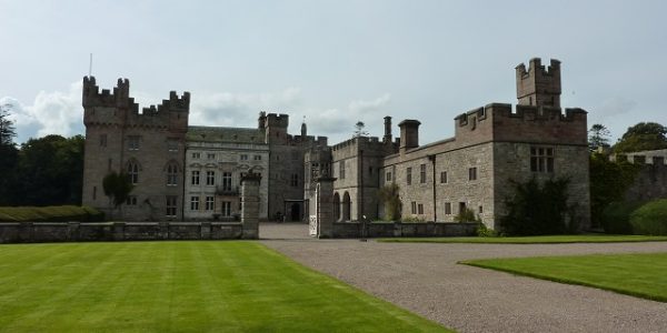
Leave the Market Place opposite the Nags Head pub and turn right at the following T junction on the A6071. After approx 0.3 miles, approach a large triangular green where you can turn left to Lanercost Priory. However, a small detour takes you via the historic Naworth Castle which is not open to the public but can be seen from the road. To do this, continue on the A6071 out of Brampton to a T junction with the A69 where you turn left. After approx 0.9 miles, turn left at a cross roads on a minor road towards Lanercost. Over a cattle grid, enter the attractive Naworth estate with good open views. Descend to a sharp left turn in the road with Naworth Castle directly ahead. Continue on the narrow lane for approx 0.8 miles to a T junction and turn right. Cross the River Irthing adjacent to the wonderful old bridge which was built around 1724. Not far beyond is Lanercost Priory car park on the right.
Lanercost Priory

Distance: 17.1 miles
Location: Lanercost Priory
Coordinates: N 54.96542, W 2.69728
Lanercost Priory is an impressive old monastery founded by Augustinian monks in the 12th century. Constructed using stone from nearby Hadrian’s Wall, it is probably the best preserved Cumbrian monastery although not as large as Furness Abbey. The Priory has had a troubled history being in the firing line of border raids in the Middle Ages and eventually was dissolved under Henry VIII in the 16th century. Part of the Priory has since been maintained as the local Parish church and this is free to visit. Adjacent, the remainder of the Priory is partly ruined but well worth visiting along with the old monastic buildings.
There are also some pleasant grounds with free entry where you will find a gift shop, restaurant, picnic area and toilet facilities. A footpath leads from here across the fields to the attractive River Irthing and the nearby historic road bridge. English Heritage property, free admission to Priory ruin for members, otherwise admission fee applies. Open daily from Easter to November and February school holidays, weekends at other times. Free car parking.
Travelling
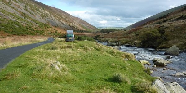
Leave the car park and turn right. The picturesque road follows the River Irthing valley and soon begins to climb towards Hadrian’s Wall. Shortly, pass through the small village of Banks which sits on the line of the Wall, although there are no obvious signs of it here. As you leave Banks, some wonderful views open up across the Irthing valley and you start a fascinating 3 mile section of road which follows the Wall and includes a number of associated fortifications. Very shortly you reach Banks East Turret car park on the right.
Banks East Turret

Distance: 18.8 miles
Location: Banks East Turret
Coordinates: N 54.97548, W 2.66510
Banks East Turret was a small fortification on Hadrian’s Wall, probably in use from when the Wall was built around AD122 to when the Romans left in the fourth century. Hadrian’s Wall consisted of many fortifications along its length, primarily at the main Forts such as Birdoswald but also every mile there was a milecastle and between the milecastles were two equally spaced turrets. The turrets were small stone watchtowers allowing observation of the surrounding Wall. Much of the Wall and building stonework has been taken for other construction over the years but the lower Walls remain here and it is an interesting place to explore with fabulous views across the Irthing valley and away towards Lakeland mountains. This turret is numbered 52a because it was the first turret west of milecastle 52, that being approx 52 Roman miles from the eastern end of the Wall.
If you follow the footpath east from Banks East Turret for approx 100m you will find Pike Hill Signal Tower which again has some lower remains to explore. This predated Hadrian’s Wall by a few decades and was used to protect the Stanegate which was the nearby Roman Road running from Corbridge to Carlisle. Due to its important position it was later incorporated into the Wall. Free car parking and free entry to local Roman ruins but no facilities.
Travelling

The road follows the Wall eastwards with great surrounding views. Initially, remains are difficult to see except at two further turrets nearby. Leahill Turret 51b is approx 0.6 miles from Banks East and another 0.3 miles beyond that is Piper Sike Turret 51a. Both are adjacent to the road on the left with limited parking roadside. Milecastles 52, 51 and 50 are no longer visible and the only obvious Wall remains are associated earthworks on the right until just before Birdoswald Fort where remains of the Wall and Turret 49b are adjacent to the road on the right. The car park for Birdoswald Fort is a short distance beyond the Fort on the right.
Birdoswald Roman Fort

Distance: 21.7 miles
Location: Birdoswald Roman Fort
Coordinates: N 54.99155, W 2.60092
Birdoswald Roman Fort was one of 16 major forts along the length of Hadrian’s Wall and is also one of the best preserved. This may have been the base for around 1000 Roman soldiers who protected the Wall. Although far from complete, archaeology has revealed much of the original layout and it is well worth exploring. The Fort is in a great position, set high above the River Irthing, with spectacular views and one of the best preserved sections of stone Wall to the east and various milecastles and turrets nearby. The Wall along this stretch was originally turf construction and that can also be seen at the Fort. There is an interesting visitor centre which tells the story of the Fort, including its use following Roman occupation.
English Heritage property, free admission for members, otherwise admission fee applies. Open daily from Easter to November and February school holidays, Wednesday to Sunday in March and weekends at other times. Cafe, gift shop and toilets on site. Pay and display parking.
Travelling
Exit the car park and turn right. Shortly, approach a T junction and turn right on the B6318 towards Gilsland. Continue approx 1.0 miles to another T junction, turn right, cross the River Irthing and enter the village of Gilsland. Continue on the minor road which bears right, climbs a small hill and passes the village school to the village car park on the left.
Gilsland

Distance: 23.6 miles
Location: Gilsland, village car park
Coordinates: N 54.98924, W 2.57952
The village of Gilsland straddles the Cumbria/Northumbria county boundary in a pretty and remote location within the Irthing valley. The village is home to the House of Meg tea rooms, the Samson Inn, the Bridge Inn and the nearby historic Gilsland Spa but the main attraction again is Hadrian’s Wall which runs immediately to the south. Behind the village car park, a short footpath bears left across the field and railway to Poltross Burn milecastle 48 which is one of the best preserved structures on the Wall. Only the lower structure remains but you can still see the route through the Wall that was a feature of the milecastles. A short circular walk through the village is possible if you continue on the footpath beyond the milecastle.
In the opposite direction from the car park, a good footpath follows an interesting section of ruined Wall which includes the remains of Willowford turrets 48a and 48b, overlooking the River Irthing. The path then descends to the river and the remains of Willowford Bridge which was the old Roman bridge across the river. Over the river, the footpath climbs to Harrows Scar milecastle 49 and along the substantial section of Wall leading to Birdoswald Fort. Free car parking and free entry to local Roman ruins.
Travelling
Exit the car park and turn left. Soon cross the Carlisle-Newcastle railway at a level crossing and continue approx 1.3 miles to a T junction with the A69. Turn right towards Carlisle on the straight main road with great views over the Irthing valley and beyond towards southern Scotland. Continue for just over 5 miles to take a right turn on the A6071 towards Brampton, the same road you left Brampton on earlier. In just under 1 mile, as you enter Brampton town take the left turn at the large triangular green towards Talkin Tarn. Very shortly, turn left at the T junction then immediate right, again towards Talkin Tarn. Proceed a short distance through the town suburbs to a T junction and turn left on the B6413. Continue out of Brampton for just over 1 mile, passing under the A69 and over a railway level crossing, to a minor road on the left which leads the short distance to Talkin Tarn car park.
Talkin Tarn Country Park

Distance: 33.2 miles
Location: Talkin Tarn Country Park
Coordinates: N 54.92408, W 2.71355
Talkin Tarn is a popular but quite well hidden country park, the main attraction being the glacial tarn set amongst meadows and woodland with some lovely distant views. The circular tarn has a well made footpath around it which makes an enjoyable 1.3 mile level stroll. The views can be fully appreciated from the many benches along the way and there is plenty of birdlife to admire. The tarn is popular for boating and you can sometimes hire a rowing boat to appreciate the surroundings from the water. Near the car park is the renovated boathouse which overlooks the tarn and houses a tea room and gift shop with adjacent play area and toilets. Open daily all year. Pay and display car park.
Travelling
Leave the car park on the minor lane to the T junction and turn left, back on the B6413. Continue for approx 1.0 miles, passing Brampton golf course, to a cross roads where you turn right towards Carlisle. The narrow road descends and soon enters woodland. Shortly beyond this the road approaches a mighty railway viaduct overhead and the roadside parking for Gelt Woods is underneath the viaduct on the right, just before Middle Gelt Bridge.
Gelt Woods

Distance: 34.9 miles
Location: Gelt Woods, Middle Gelt Bridge
Coordinates: N 54.90867, W 2.73075
The picturesque Gelt Woods follow the cascading River Gelt through a deep sandstone ravine and provide a lovely walk along the river. A reasonable but sometimes muddy footpath follows an undulating linear route through the woods, approx 1.8 miles from Middle Gelt Bridge to Low Gelt Bridge. The woods are also famous for a historic Roman quarry, overlooking the river, from which stone for Hadrian’s Wall was carved out nearly two thousand years ago. The quarry cliff face is found approx 1 mile from the parking area and the chisel marks can still be seen today. An inscription made during Roman times can also still be seen in the quarry face although it is difficult to find and reach. The public footpath leads downstream from the parking area. Free roadside car parking but no other facilities.
Travelling
Continue over Middle Gelt Bridge and follow the road to the right. Continue to follow signs for Carlisle and after approx 0.9 miles meet a T junction where you turn right. Good views open up ahead towards Carlisle and beyond. Shortly, pass an impressive looking tower attached to a farm on the right. This is known as Toppin Castle and is a private residence built in the mid 19th century. Approx 1.0 miles beyond, meet a T junction and turn right to enter the small village of Corby Hill. Turn left at the traffic lights on the main A69, pass a service station with shop and enter the adjoining village of Warwick Bridge. Continue through the village and soon cross the River Eden on the bridge which gave the village its name. Immediately take the left turn which is the B6263 towards Wetheral. The road follows the River Eden and enters Wetheral village after approx 1.2 miles. Continue a short distance through the village to a left turn towards the railway station, where the village shop is on the left and the village green is ahead. Roadside parking in this area.
Wetheral

Distance: 40.5 miles
Location: Wetheral, village green
Coordinates: N 54.88235, W 2.83356
Wetheral is a pleasant village set high above the River Eden with a number of attractions for visitors. The village became affluent when the Carlisle-Newcastle railway was built and there are some wonderful properties from that era. There is free parking around the large village green and a stroll around the village is well worthwhile. The Posting Pot cafe adjacent to the village shop, the Crown Hotel and Fantails restaurant can provide refreshments. No public toilets.
A suggested short walk, visiting the majority of local attractions, leads from the village green past the village shop to the pretty railway station. Detour across the impressive railway viaduct, high above the River Eden, giving good views. Return to the station and down the 99 steps to the river. Turn right along the lane and soon a footpath on the right takes you to the attractive Holy Trinity Church. Back towards the river another footpath leads upstream to the Eden Benchmark bench sculpture and continues past the imposing Corby Castle with its cascading waterfall on the opposite side of the river. Continue to Wetheral Woods and St Constantine’s caves, hewn out of the sandstone rock, overlooking the river. Head back across the fields to visit Wetheral Priory Gatehouse, the only remaining part of the historic Wetheral Priory and open daily with free entry. Continue along the lane and return to the village green.
Travelling
Return back along the B6263 a very short distance and take the left turn towards Scotby. Continue approx 1.7 miles to enter the village of Scotby at a T junction with the village shop ahead. Turn right towards Carlisle and pass the village church on the right. Continue through the village for approx 0.6 miles to a T junction with the A69 and turn left. Shortly, meet a large roundabout over the M6 motorway (M6 junction 43) and take the second exit on the A69 which soon enters Carlisle. Continue straight ahead at the Tesco traffic lights, straight ahead at the next traffic lights and continue for approx 0.5 miles to pass Carlisle United football ground and shop on the right. Shortly beyond, get in the right lane at the traffic lights and turn right, towards ‘A595 West’. Continue approx 0.5 miles to another junction with traffic lights and turn right, ‘A595 West’. Soon approach Hardwicke Circus roundabout and take the first exit, still ‘A595 West’. Carlisle Castle is ahead on the right and the car park is just beyond but with no right turn you need to continue approx 0.3 miles to a roundabout and double back to Castle car park turning on the left, immediately before a footbridge over the road.
Carlisle

Distance: 46.6 miles
Location: Carlisle, Castle car park
Coordinates: N 54.89652, W 2.94328
Return to start point.